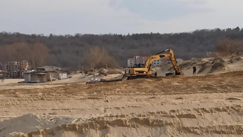
Doubts about the destruction of dunes on Smokinya beach again raise the question of mapping the dunes on the Black Sea coast

"There are definitely no destroyed dunes on the beach. Before cleaning the beach, we called an authorized cadastre company, which put pegs on the dunes. They are placed 2.5 meters from the beginning of the dunes ", said the concessionaire of the beach Ivan Alexiev in front of Nova TV. "This year the sea was very rough, the restaurants had almost fallen and we decided to remove them, eventually building new ones in their place with the appropriate permits," said Alexiev. He stressed that they have cleared the ground for new establishments for which investors can prepare projects. Alexiev said that under the old restaurants old stoves and waste were removed at a depth of more than a meter, which makes it clear that the need to renovate the grounds is absolutely justified. New applications for building permits will be submitted for approval by the various institutions, but only when they are ready. The possibilities for their connection to the treatment plant and to electricity are being prepared.
In 2019, it was plowed with an excavator at the Smokinya camping site, with which it was irretrievably destroyed, the results of the inspection of the Regional Inspectorate for Environmental Protection showed at the time. The owners of several caravans wanted to provide a better view of the beach, the case ended with a final statement that the dune was not destroyed, but only damaged, reminded by Nova.
This raises once again the issue of mapping the dunes and the discrepancies in the data of the Ministry of Environment and Water (MOEW) and the Ministry of Regional Development and Public Works (MRDPW). The beaches with larger habitats on dunes are near Sozopol, Arkutino and Primorsko to the south and near Nessebar and Shkorpilovtsi to the north. In the summer of 2020, the specialists from the Green Laws initiative study the dunes on the Bulgarian Black Sea coast and establish striking discrepancies between the mapping of dunes of the Ministry of Environment and Water and the specialized map of the Ministry of Regional Development and Public Works on our Black Sea coast. In practice, only half of the famous dunes in Bulgaria turned out to be mapped in the cadastre.
The initiative signals that none of the available white dunes on the neighboring beaches of Irakli and Vaya are reflected in the cadastre of the Ministry of Regional Development and Public Works (MRDPW). Both beaches are in the protected area Emine - Irakli. Therefore, in 2012 the dunes were mapped under the project "Mapping and determining the conservation status of natural habitats and species", commissioned by the Ministry of Environment and Water. According to these studies, Irakli Beach has a strip of white dunes that starts from the Vaya River and reaches almost to the end of the beach to the south. These dunes are described in the forms of the protected area "Emine - Irakli", and their area is estimated at 38.2 acres of white dunes. But in the specialized map of the dunes to the cadastre is not reflected any of them.
Until now, the Ministry of Regional Development has not used the data on the mapped dunes of the Ministry of Environment and Water, although it has had six months to do so. So far there is no clear answer from the regional ministry as to why this is not happening so far. Then there will be no uncertainties which beaches have dunes and which dunes should be protected and in what way. The lack of adequate mapping and indication of all dunes puts investors in a vague position, but also in the opportunity to take advantage of the gaps of institutions, according to one ministry, some beaches are dunes, and according to maps of the other ministry are not dunes.
